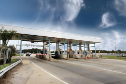
Toll Survey
Accurate vehicle classification, peak-hour analysis and revenue forecasting to improve toll efficiency and planning.
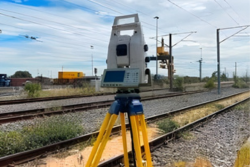
Total Station Survey
High-precision land measurement using advanced total station technology for accurate mapping and alignment.
FWD Survey
Pavement strength evaluation using Falling Weight Deflectometer to measure surface deflection and structural capacity.
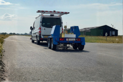
NSV Survey
Network Survey Vehicle-based road condition assessment for capturing pavement distresses, roughness, and surface profile.
Road Marking
Professional road marking surveys and layout planning for safe lane guidance and traffic management and enhance road visibility.
PT/IPT Survey
Public Transport / Intermediate Public Transport movement analysis for route efficiency and passenger flow.
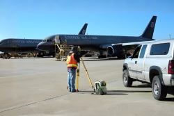
Airport Survey
Detailed traffic and passenger movement studies for airport access, parking, and support terminal expansion.
Railway Station Survey
Comprehensive study of passenger flow, access roads, parking, and interchange movement around railway stations.
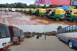
Bus Terminal Survey
Analysis of bus operations, passenger volume, route movements, and terminal circulation efficiency.
Soil Investigation
Ground condition assessment through test pits to evaluate soil layers and bearing capacity and reliable construction planning.
Queue Length Survey
Real-time measurement of vehicle queue lengths at junctions, tolls, and signals for traffic flow analysis and improve junction design.
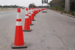
Road Safety Audit Survey
Systematic safety evaluation of roads to identify risks, blackspots, and engineering improvements and enhance road safety
Urban Planning
Data-driven planning support for city development, mobility enhancement, and infrastructure design and enhance the structure.
Rural Planning
Assessment and planning of rural road networks, connectivity, and mobility needs and improved accessibility and development.